DJI Agras T70P: Mapping y Spraying — Route, Fruit Tree, A-B, Manual Plus y Resumption
DJI Agras T70P: Mapping y Spraying — Route, Fruit Tree, A-B, Manual Plus y Operation Resumption
El chapter 5 del DJI AGRAS T70P User Manual v1.0 (2025.11) es el centro operativo del aircraft. Conecta flow-meter calibration, Mapping, Route, Fruit Tree, A-B Route, Multitask, Manual / Manual Plus, prescription maps, operation resumption y Empty Tank Warning. La forma correcta de usarlo es pensar en un workflow completo: calibrate → map → plan → review → execute → pause/resume → refill/maintain.
Resumen: recalibre el flow meter cuando cambie liquid viscosity o cuando actual usage difiera significativamente de theoretical usage. Para calibration, DJI indica aproximadamente 2 L de agua. Route Mapping y Fruit Tree Mapping crean HD maps. Route/Fruit Tree planning permite boundaries, obstacles y non-spraying areas. A-B Route usa points A y B para generar parallel passes. Manual Plus está pensado para áreas pequeñas/irregulares. Route/Fruit Tree operations pueden guardar breakpoint y reanudarse después de refill, battery change o manual obstacle avoidance.

1. Flow-meter calibration is the first spraying checkpoint
Before relying on application data, make sure the delivery system is calibrated for the liquid and hardware configuration actually being used.
2. Recalibrate when liquid viscosity changes
Different liquid behavior can change the relationship between commanded and actual flow.
3. Recalibrate when actual usage differs from theoretical usage
A significant discrepancy is a direct trigger in the source.
4. Calibration liquid amount
DJI instructs the operator to fill the tank with approximately 2 L of water for the flow-calibration procedure.
5. Open Flow Calibration in Operation View
Use the supported DJI Agras workflow rather than manually guessing flow coefficients.
6. Additional sprinklers require recalibration
After adding or replacing extra sprinklers, recalibrate the delivery-pump flow rate.
7. Hardware changes can invalidate previous calibration
Do not assume a flow baseline remains valid after nozzle/sprinkler configuration changes.
8. Mapping starts with the right task type
Choose Route Mapping or Fruit Tree Mapping depending on the field and crop structure.
9. Add boundary points
With Crosshair selected, add the field boundary points in Operation View.
10. Save the field before mapping flight
Preserve the planned geometry before sending the aircraft to reconstruct the area.
11. Run the mapping flight
Start the mapping operation and wait for the aircraft to collect the required imagery/data.
12. Wait for reconstruction
The generated HD map becomes the planning base for subsequent Route Planning or Identify Field workflows.
13. HD map enables detailed planning
Use the reconstructed map to inspect field geometry, boundaries and obstacles more precisely than with a generic base map.
14. Mapping results can be uploaded to the cloud
This allows the same account to access the data later from another remote controller.
15. Cloud sync supports fleet/controller continuity
Do not treat one physical controller as the only place where the field data can exist.
16. Prescription maps
Variable-rate operations can use prescription maps supported by DJI Agras.
17. Cloud prescription-map download
The app can download prescription maps from the cloud.
18. DJI Terra task import
Tasks planned in DJI Terra can be transferred to the controller.
19. DJI SmartFarm Web task import
Downloaded operations can also be transferred using a microSD card.
20. Imported tasks appear in the operation list
Review them before execution rather than assuming imported geometry is ready for the current field condition.
21. Planning a Route operation
Select Route, choose the desired task type and create the field geometry.
22. Add field boundaries
Boundary accuracy affects route generation and where the aircraft will spray.
23. Mark obstacles
Physical obstacles should be represented in the planning layer so the generated route reflects the real site.
24. Mark non-spraying areas
Use these for areas where application should not occur.
25. Let DJI Agras generate the route
After field geometry and exclusions are defined, the app generates the operation route.
26. Flight Route Settings
Adjust task parameters here instead of accepting defaults without review.
27. Multiple Fields
The app supports workflows spanning multiple planned fields.
28. A-B Route
A-B Route provides a faster planning method when the field can be represented by parallel passes.
29. Custom waypoints
Use custom planning paths when the operation needs more specific geometry.
30. Fruit Tree operations
Fruit Tree mode can use a reconstructed HD map and allows 3D review.
31. 3D route-height review
Review planned route height relative to ground and nearby objects before saving.
32. Orchard geometry needs extra attention
Tree height, terrain changes and nearby structures can make a flat 2D route assumption inadequate.

33. Performing Route/Fruit Tree operations
Place the aircraft on open, flat ground before starting the task.
34. Configure Task Settings
Review payload/application parameters, route parameters and relevant sensing behavior.
35. Rectify Offset
This tool can align the planned field with the actual field location when the map and real position do not match perfectly.
36. Connection Points
Add connection points when needed to route the aircraft around obstacles on connection or RTH paths.
37. Prescription maps can be applied to the task
Use them only when the operation requires variable-rate application and the data is correct for the field.
38. Automatic route execution
Once started, the aircraft follows the generated operation route automatically.
39. Route spacing and non-spraying areas
The aircraft does not spray while flying route spacing or designated non-spraying areas.
40. Spraying occurs on the active route segments
The application system operates on the portions of the route designated for treatment.
41. Pause with roll/pitch input
The operator can pause the task and manually control the aircraft when needed.
42. A-B Route: record Point A first
DJI says Point A and its heading should be recorded before Point B.
43. Record Point B
After A is established, set the second reference point.
44. Route R/R' by default
The app generates parallel passes from the A/B geometry.
45. L/L' alternative
The operator can switch the route orientation when appropriate.
46. Heading can be set for each point
This controls how the generated passes align with the field.
47. Manual mode
Manual operation is appropriate for small or irregular areas where full route planning may not be necessary.
48. Manual Plus
Manual Plus adds preset lateral spacing while retaining direct operator control.
49. Automatic spraying in Manual Plus
The aircraft can spray automatically when accelerating forward, backward or diagonally.
50. No spraying while moving sideways
This is a specific behavior described by DJI and should be understood before using Manual Plus.
51. Operation Resumption
Route and Fruit Tree operations can record a breakpoint when the task is exited under suitable GNSS conditions.
52. Why breakpoints matter
They let the operator stop for refill, battery replacement or obstacle handling without rebuilding the task from scratch.
53. Resume after refill
Land, refill safely, return to the operation and select the saved breakpoint or another available return point.
54. Resume after battery change
The same breakpoint logic supports power-cycle interruptions.
55. Resume after manual obstacle avoidance
If automatic bypass fails, switch to Manual mode, record the current position as breakpoint and maneuver around the obstacle.
56. Completely clear the obstacle before resuming
Do not tap Resume while the aircraft or return path is still inside the obstacle hazard area.
57. Smart Resume
Smart Resume can calculate an optimal return point based on the breakpoint and current aircraft position.
58. Why Smart Resume can reduce risk and wasted energy
Reducing unnecessary return distance matters especially when the aircraft is carrying a heavy payload.
59. Empty Tank Warning
The aircraft can calculate and display the expected empty-tank point.
60. Enable Display Empty Tank Point
Use the app setting when you want the predicted point visible during the task.
61. Choose the empty-tank action
Configure the desired behavior before starting the operation.
62. When empty-tank warning appears
Sprinklers stop automatically according to the source.
63. Refill procedure
Land, stop the motors, refill the tank and secure the tank cover before continuing.
64. Do not refill with motors running
The source sequence places motor shutdown before refill.
65. Flow calibration decision tree
- new liquid viscosity? recalibrate;
- actual/theoretical usage mismatch? recalibrate;
- additional sprinklers added/replaced? recalibrate delivery-pump flow;
- no change and usage matches? preserve current calibration unless DJI Agras requires otherwise.
66. Mapping decision tree
- standard field geometry → Route Mapping;
- orchard/tree structure → Fruit Tree Mapping;
- existing cloud/SmartFarm/Terra task → import and verify;
- small/irregular spot work → Manual or Manual Plus.
67. Operation-resumption checklist
- suitable GNSS;
- breakpoint recorded;
- reason for pause resolved;
- battery/payload ready;
- obstacle completely cleared;
- return point reviewed;
- route alignment verified;
- Resume selected only when safe.
68. T70P spraying-system service branch
If the operational issue is tank, nozzle, signal cable or liquid-level sensing, identify that subsystem before replacing parts.
69. 70L Water Tank
Ares Acres carries the T70P OEM 70L Water Tank for verified tank-side service.
70. Rear 4-Nozzle Modification Kit
This changes the spraying configuration and should be followed by the calibration steps required by DJI.
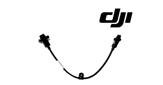
71. Centrifugal Nozzle Signal Cable
Use this service path when diagnosis points to the nozzle signal path rather than the pump or tank itself.
72. Liquid Level Gauge Signal Cable
Liquid-level sensing is a separate branch from nozzle delivery.
73. Common error: changing nozzles without recalibration
DJI tells operators to recalibrate after adding/replacing additional sprinklers.
74. Common error: importing a task and flying it without field verification
Imported geometry should be reviewed against current real-world conditions.
75. Common error: resuming before the obstacle is fully cleared
Manual obstacle avoidance must finish before the automatic task continues.
76. Common error: side movement in Manual Plus expecting spray
The source says it does not spray while moving sideways.
77. Common error: refilling with motors active
Land and stop motors first.
78. Questions
When should I calibrate the flow meter?
When liquid viscosity changes or actual usage differs significantly from theoretical usage.
How much water does DJI use for calibration?
Approximately 2 L.
What is A-B Route?
A parallel-pass operation generated from reference points A and B.
Can Route/Fruit Tree tasks resume after refill or battery change?
Yes, using the recorded breakpoint when conditions allow.
Does Manual Plus spray while moving sideways?
No.
What happens at Empty Tank Warning?
The sprinklers stop automatically; land, stop motors and refill.
Source and revision
Primary source: DJI AGRAS T70P User Manual v1.0, 2025.11, chapter 5.