DJI Agras T100 D-RTK 3 Tutorial
Share
U.S.A. FIRST — DJI AGRAS TECHNICAL SUPPORT, PARTS & OPERATOR EDUCATION
The DJI D-RTK 3 Agriculture Edition is one of the most important precision-positioning tools in a DJI Agras operation. For a commercial operator, the objective is not simply to turn the base station on and see an RTK icon. The objective is to establish a repeatable positioning workflow that the aircraft, remote controller, base station, and operator all understand before a mission begins.
This Ares Acres operator guide expands the DJI training video into a complete field manual for DJI Agras T100 D-RTK 3 setup, linking, PPP positioning, Network RTK, Custom Network RTK, saved coordinates, and ionospheric-interference operations. It is designed primarily around the DJI Agras T100 workflow while also explaining the operating principles that matter anywhere the D-RTK 3 Agriculture Edition is supported by the applicable aircraft, remote controller, firmware, and regional configuration.
Shop the DJI Agras T100 D-RTK 3 High-Precision GNSS Mobile Station (USA Version) | DJI T100 Parts | DJI Agras Parts | Contact Ares Acres
Quick Answer: How Do You Set Up the DJI D-RTK 3 for the T100?
- Place the D-RTK 3 in a stable, open location with a clear view of the sky.
- Power on the station using the DJI press-then-press-and-hold power sequence.
- If it is the first use, activate the station before attempting field operations.
- Power on the DJI Agras aircraft and remote controller and confirm the aircraft is linked to the controller.
- Open the DJI Agras app and enter Device Management.
- Select the D-RTK mobile station and begin linking.
- After linking, open the aircraft RTK settings and select D-RTK 3 Agriculture Edition as the RTK signal source.
- Select the positioning mode appropriate for the site: PPP, Network RTK, Custom Network RTK, or Custom Coordinates.
- Wait until the positioning state shown by the app and station is suitable for the mission before taking off.
- Once the base position is established, do not move or rotate the station during the operation.
The exact labels and screen arrangement can change with DJI Agras app versions, aircraft firmware, D-RTK firmware, and regional configuration. Treat the current DJI Agras app and the current manual for your equipment as the final authority if a menu differs from the training video.
What the D-RTK 3 Does in a DJI Agras Operation
Agricultural drone missions depend on geographic consistency. If a field boundary, A-B line, route, obstacle, application lane, or saved mission is represented in one coordinate reference while the aircraft is navigating from another imperfect solution, the practical result can be positional drift. A high-precision RTK workflow reduces that uncertainty by giving the aircraft a correction source that improves the quality and repeatability of its positioning.
The D-RTK 3 Agriculture Edition should therefore be treated as part of the mission-control system rather than as a standalone accessory. The positioning chain includes:
| Layer | Purpose | Operator concern |
|---|---|---|
| GNSS satellites | Provide raw satellite positioning signals | Sky visibility, satellite geometry, interference |
| D-RTK 3 base station | Establishes or references a precise base position and supplies correction information | Correct location, stable setup, correct positioning mode |
| Remote controller / DJI Agras app | Manages activation, linking, RTK source, positioning mode and mission settings | Correct device selected, current configuration, correct mode |
| Aircraft RTK system | Uses the correction source for high-precision navigation | RTK source, connection state, aircraft antenna/system health |
| Saved coordinates | Allow repeatable setup at a known base point | Coordinate naming, location fidelity, recordkeeping |
For T100 operators troubleshooting the aircraft-side RTK hardware, Ares Acres also carries the DJI Agras T100 OEM RTK Antenna Module and DJI Agras T100 OEM RTK Mushroom Head Adapter & Connector.
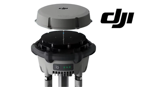
D-RTK 3 Controls and Indicator Lights
The training video begins with four items an operator should recognize before entering any menus: the power button, battery-level indicator, mode indicator, and satellite/GNSS signal indicator.
Power Button
DJI uses a two-step power sequence: press once, then press and hold to power the station on or off. Operators familiar with DJI intelligent batteries will recognize the same general interaction pattern.
Battery-Level Indicator
The video simplifies the display as green for sufficient battery and red for low battery. Current DJI documentation provides more detailed battery-state ranges, so use the actual indicator pattern in the current manual for the station rather than assuming that every firmware revision will display only a simple green/red state.
A low base-station battery is an operational risk because an RTK interruption can stop a precision workflow in the middle of a field. Include the D-RTK 3 in the same preflight energy check used for the aircraft batteries and remote controller.
Mode Indicator
For the agriculture/base-station workflow shown in the video, the operator expects the appropriate normal operating indication, shown as green in the training sequence. If the mode indication is not what your configured workflow expects, verify the operating mode before launching the aircraft.
Satellite / GNSS Signal Indicator
The station requires a usable satellite environment. The video instructs operators to proceed when the positioning signal is good and the indicator is green. DJI documentation also differentiates GNSS reception by satellite-count/state indicators. The important operational principle is the same: do not treat a powered-on station as a positioned station.
First Use: Activate the D-RTK 3 Before Field Operations
First-time setup has an extra step. DJI requires the D-RTK 3 to be activated before normal use. The current manual also instructs users to activate the internal battery by charging the station before first use.
A practical first-use sequence is:
- Charge the D-RTK 3 before deployment.
- Power on the aircraft and remote controller.
- Confirm the aircraft is linked to the remote controller.
- Power on the D-RTK 3.
- Make sure the remote controller has the internet connectivity required for activation.
- Open DJI Agras → Device Management → D-RTK Station.
- Select the station and connect.
- Follow the activation prompts until activation is complete.
If a newly purchased station will not enter normal positioning operation, confirm activation status before assuming there is a GNSS, antenna, aircraft, or hardware failure.
Where to Place the D-RTK 3 Base Station
RTK accuracy begins with physical setup. A perfect app configuration cannot compensate for a poor base-station location.
DJI guidance calls for a stable, open environment with a clear view of the sky. In practice, avoid positioning the station immediately beside buildings, large vehicles, tree lines, metallic structures, high-voltage infrastructure, powerful transmitters, or other environments that can block satellites, create multipath reflections, or introduce radio interference.
DJI's current D-RTK 3 Agriculture Edition manual includes several useful siting principles: keep the antenna environment open, avoid significant obstructions above the horizon, maintain separation from high-power radio sources and high-voltage transmission lines, and avoid strong multipath environments. The top of the station should be kept appropriately level for the configured setup.
Most important: once the station is leveled and its coordinate solution is being used by the fleet, do not casually reposition it. Moving the base after a mission has begun changes the spatial reference on which the aircraft is depending.
Step-by-Step: Link the D-RTK 3 to the DJI Agras T100
With the aircraft and remote controller already connected:
- Power on the D-RTK 3.
- Open the DJI Agras app.
- Enter Device Management.
- Select the D-RTK mobile station / D-RTK station entry.
- Choose Linking or the equivalent current command.
- Select the correct D-RTK 3 if multiple devices are visible.
- Wait for the app to confirm that linking is complete.
- Open the aircraft RTK Settings.
- Change the RTK signal source to D-RTK 3 Agriculture Edition.
- Verify that the station, remote controller, and aircraft remain connected before selecting the positioning mode.
If the controller itself is damaged, regionally mismatched, or otherwise suspect, see the DJI Agras T100 OEM Remote Controller (USA Version).
Understanding the Four Positioning Choices
| Mode | Best use | Internet / RTK service | Primary advantage |
|---|---|---|---|
| PPP | Remote site without Network RTK service | Designed for network-free positioning scenarios | Lets the station establish a position without a local Network RTK correction service |
| Network RTK | Site with supported Network RTK service | Required | Fast, high-precision base calibration using network corrections |
| Custom Network RTK | Site using compatible third-party/custom correction service | Required | Uses operator-provided network RTK credentials/service |
| Custom Coordinates | Returning to a previously surveyed/saved base point | Can avoid repeating the original convergence process when correctly reused | Repeatable base position from a known saved coordinate |
These modes should not be thought of as four competing accuracy buttons. They are four ways of answering a more important question: How does the base station know the coordinates of the exact point where it is standing today?
Scenario 1: Completely Network-Free Operation — Use PPP
The video identifies PPP as the appropriate workflow when operating in a completely network-free environment. This is especially relevant to agricultural operations in remote acreage where cellular coverage or local RTK correction services are unavailable.
A disciplined PPP workflow is:
- Set the D-RTK 3 on a stable physical point that can be reproduced in the future.
- Power on, link, and select D-RTK 3 Agriculture Edition as the RTK source.
- Select PPP positioning.
- Allow the station to converge. Do not move it while it is establishing the position.
- Wait for the app to show that the required positioning state has been reached.
- Save the resulting base coordinates with a clear site name.
- Begin the agricultural mission only after the positioning state is confirmed.
Current DJI T100 published specifications list PPP convergence at approximately 20 minutes, with positioning performance around 30 cm horizontal RMS and 40 cm vertical RMS after convergence. Actual field results depend on satellite environment and other conditions.
Important: What About the 20 cm / 50 cm Options Shown in Some Training Footage?
The supplied training narration describes selecting a PPP positioning accuracy of 50 cm or 20 cm. Operators should not assume those labels are a universal D-RTK 3 specification across every region, aircraft, Agras app version, and firmware release.
Current published DJI T100 specifications describe PPP performance differently: approximately 30 cm horizontal RMS and 40 cm vertical RMS after convergence. If your DJI Agras app shows a 20 cm/50 cm target, threshold, or selection, follow the current on-screen prompts and the current manual for that exact firmware and region. Do not force an older tutorial's UI assumption onto a newer configuration.
Scenario 2: Network Available — Network RTK or Custom Network RTK
Where a supported Network RTK correction service is available, the station can use network corrections to establish a high-precision base position. This is the preferred setup shown in the video before a later ionospheric-interference event because it gives the operator a known position that can be saved and reused.
Recommended workflow:
- Set the station on the permanent or repeatable base point.
- Connect the remote controller to the required network service.
- Select Network RTK or Custom Network RTK, depending on the correction source.
- Allow the D-RTK 3 to obtain its high-precision position.
- Save the station coordinates before beginning production work.
- Name the saved coordinate so another operator can identify the exact physical base point later.
DJI's current T100 specifications list Network RTK calibration performance substantially tighter than standalone PPP, subject to the usual baseline/service conditions.
Scenario 3: Ionospheric Interference and Saved Custom Coordinates
The most valuable part of the training video is the repeat-use strategy. If the operator has already established and saved a reliable coordinate for a known base point, that coordinate becomes an operational asset.
The simplified field concept is:
- On a good day, establish the D-RTK 3 at the chosen permanent base point using Network RTK, Custom Network RTK, or the appropriate initial positioning method.
- Save that position.
- If the station later needs to be restarted or re-established when ionospheric conditions make normal positioning more difficult, return the station to the same physical point.
- Select Custom Coordinates.
- Choose the previously saved coordinate for that exact point.
- Verify the resulting position and RTK state before launching aircraft.
This is not permission to choose any old saved coordinate. A saved coordinate belongs to a specific physical base location. Selecting the coordinate for Field A while the tripod is physically standing at Field B creates a systematic position error across the mission.
Why Saved Coordinates Should Be Managed Like Fleet Assets
Commercial operators should build a coordinate-management convention rather than leaving saved points with names such as “Point 1” or “RTK Base.”
A practical naming structure might be:
FARM-FIELD-BASE-01
CLIENT-SITE-NORTH-RTK
ORCHARD-BLOCK7-BASE-A
For each saved base point, maintain:
- Exact saved name in DJI Agras
- Farm/client name
- Field/block
- Physical marker description
- Date first established
- Positioning method used to establish it
- Operator
- Notes about nearby interference or obstructions
- Photos of the physical setup point if useful
This turns RTK from operator memory into a repeatable fleet process.
Never Move the D-RTK 3 After the Position Is Established
Once a mission is using the D-RTK 3 as its reference, the station's physical position is part of the navigation solution. DJI warns that base-station displacement can generate a warning and disrupt or terminate a mission.
If a vehicle, worker, wind event, tripod failure, or equipment movement knocks the station out of position:
- Treat the displacement as an operational event, not a cosmetic warning.
- Follow the aircraft/app safety prompts.
- Do not simply drag the tripod approximately back into place and continue.
- Re-establish the base at the correct physical point and verify positioning before resuming precision operations.
For farms that repeatedly use the same base point, a durable ground reference or surveyed marker can materially improve setup repeatability.
Using One D-RTK 3 With Multiple DJI Agras Aircraft
The D-RTK 3 Agriculture Edition can support simultaneous positioning service for multiple compatible DJI aircraft. This is valuable for larger operations where several aircraft are working from the same base reference.
However, the video provides an important operating caution: do not casually switch the base station's positioning mode while other aircraft are actively connected and depending on it. A mode change can alter the positioning service being supplied to those aircraft and can affect positioning accuracy or ongoing operations.
A commercial multi-aircraft SOP should require:
- One designated RTK/base-station operator or mission lead
- One agreed positioning mode for the active work block
- Confirmation before any mode change, restart, or relocation
- No base relocation while aircraft are flying
- One known saved coordinate for repeat work at the site
- RTK status confirmation on every remote controller before takeoff
D-RTK 3 vs O4 Relay: Do Not Confuse Positioning With Communications
RTK positioning and radio-link extension solve different problems. The D-RTK 3 provides the high-precision positioning reference described in this guide. A communications relay is used to improve or extend the aircraft-control/data link in difficult RF or terrain environments.
If your issue is control-link coverage rather than geographic precision, see the DJI Agras T100 OEM O4 Relay Signal Repeater System (USA Version). Do not attempt to solve an RTK configuration problem by changing communications hardware, or vice versa.
Preflight D-RTK 3 Checklist
| Check | Pass condition |
|---|---|
| Physical location | Stable, open, repeatable, unobstructed |
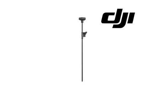
| Tripod / pole | Secure and not likely to move during mission |
| D-RTK battery | Sufficient for the entire planned work block |
| Activation | Station activated and recognized |
| Aircraft-controller link | Normal before station linking |
| D-RTK linking | Correct station shown in Device Management |
| RTK source | D-RTK 3 Agriculture Edition selected when intended |
| Positioning mode | PPP, Network RTK, Custom Network RTK, or Custom Coordinates deliberately selected |
| Coordinate | Correct saved coordinate for the exact physical point when using Custom Coordinates |
| Position quality | Required positioning state reached before takeoff |
| Fleet coordination | No unplanned station movement or mode changes during multi-aircraft operation |
Troubleshooting the DJI D-RTK 3
| Symptom | Likely branch to investigate | First action |
|---|---|---|
| Station will not power on | Battery state / charging / hardware | Charge with compatible power source and retry DJI power sequence |
| New station will not operate normally | First-use activation | Verify activation through Device Management with controller online |
| D-RTK 3 not found in Device Management | Power, mode, proximity, controller/app state | Confirm station is powered, correct device page is open, then restart linking workflow |
| Station links but aircraft is not using it | RTK signal-source selection | Open RTK settings and confirm D-RTK 3 Agriculture Edition is selected |
| Poor satellite state | Obstruction / multipath / site choice | Move setup to a more open location before establishing coordinates |
| PPP is taking time | Normal convergence / satellite environment | Keep station stationary and allow convergence; current DJI spec lists about 20 minutes under supported conditions |
| Network RTK cannot calibrate | Internet, service credentials, correction source | Verify network and RTK service before troubleshooting aircraft hardware |
| Custom coordinate gives unexpected position | Wrong saved point / wrong physical setup location | Stop and verify the coordinate belongs to the exact point occupied by the station |
| RTK becomes abnormal after base movement | Station displacement | Re-establish the base position; do not continue from an approximate location |
| One aircraft has RTK trouble while others are normal | Aircraft-side RTK hardware/configuration | Compare aircraft RTK settings and inspect the affected aircraft branch |
| Several aircraft lose RTK together | Base station / shared correction source / mode change | Inspect the common D-RTK/network/base-station layer first |
Aircraft-Side RTK Diagnosis
If the D-RTK 3 is known-good and several other aircraft use it normally, but one T100 consistently fails to obtain or maintain the expected RTK state, the diagnostic focus moves toward the aircraft and controller configuration.
Useful T100 repair paths include the T100 OEM RTK Antenna Module, the RTK Mushroom Head Adapter & Connector, and the broader DJI T100 Parts catalog. Do not order an RTK module solely because the aircraft has a positioning warning; first isolate the base station, settings, saved-coordinate selection, firmware, controller, and site environment.
D-RTK 3 Maintenance and Storage
A precision base station should be maintained as instrumentation, not thrown into the same bin as ordinary field accessories.
- Inspect the tripod/pole and locking hardware before deployment.
- Keep connectors and covers clean and dry.
- Protect the station from impact during transport.
- Charge before long field days rather than relying on the previous day's remaining capacity.
- Keep firmware management controlled across the base station, aircraft, and remote controller.
- After an update, verify linking and positioning before arriving at a production field.
- For long storage, follow DJI's current battery-state and temperature guidance for the D-RTK 3.
DJI lists the D-RTK 3 AG with a 6500 mAh internal battery, approximately seven hours of operating time under specified conditions, and IP67 environmental protection. Environmental protection does not eliminate the need for careful handling, dry storage, and connector inspection.
Firmware Updates: Treat the D-RTK 3 as Part of the Fleet Configuration
A commercial fleet should record which D-RTK firmware, aircraft firmware, remote-controller software, and DJI Agras app version are in service. When practical, avoid discovering an unexpected compatibility problem at the edge of a field.
For D-RTK firmware updates, follow DJI's current D-RTK 3 documentation and DJI Assistant 2 workflow. Keep equipment adequately charged, do not disconnect the USB-C connection during an update, and complete a functional link/positioning test after the update before returning the station to unrestricted fleet service.
Recommended Ares Acres RTK Field SOP
- Choose a base point. Use a stable, repeatable physical location with a clear satellite environment.
- Name it. Create a site-specific naming convention before saving coordinates.
- Establish it correctly. Use Network RTK/Custom Network RTK where available, or PPP where network service is unavailable.
- Save the coordinate. Treat it as a fleet record tied to the physical marker.
- Link deliberately. Verify the exact D-RTK 3 and exact RTK source on every controller.
- Verify every aircraft. Do not assume one aircraft's RTK status represents the entire fleet.
- Freeze the base. No physical movement or positioning-mode changes during active missions without fleet coordination.
- Log anomalies. Record satellite, link, positioning, displacement, and firmware events.
- Re-use saved coordinates correctly. Same saved coordinate only at the same physical base point.
- Diagnose by layers. Site → base station → network/corrections → controller/app → aircraft RTK hardware.
Frequently Asked Questions
What is the DJI D-RTK 3 Agriculture Edition used for?
It provides a high-precision positioning reference for supported DJI Agras aircraft, helping improve the geographic consistency and repeatability of precision agricultural missions.
How do I turn on the DJI D-RTK 3?
Use DJI's press-then-press-and-hold power-button sequence.
Does a new D-RTK 3 need activation?
Yes. DJI requires activation before first normal use. The controller needs the connectivity required by the activation process.
Where is the D-RTK 3 linking menu?
In the workflow shown in DJI training, connect the aircraft and controller, open DJI Agras, enter Device Management, select the D-RTK station, and start linking.
What RTK signal source should I select for a D-RTK 3?
Select D-RTK 3 Agriculture Edition in the applicable RTK settings when you intend the aircraft to use that station.
What is PPP positioning?
PPP is the network-independent positioning workflow DJI provides for scenarios without Network RTK service. It requires convergence before the station's position is ready for use.
How long does D-RTK 3 PPP convergence take?
Current DJI T100 specifications list approximately 20 minutes under supported conditions.
Is D-RTK 3 PPP accuracy exactly 20 cm?
Do not assume that. Current DJI T100 published specifications list PPP at approximately 30 cm horizontal RMS and 40 cm vertical RMS after convergence. Some tutorial/app versions may display different target options or labels.
What is Network RTK?
It uses a compatible network correction service to establish high-precision positioning. Availability and configuration depend on region and service.
What is Custom Network RTK?
It allows use of compatible custom/third-party network RTK correction settings supported by the DJI Agras workflow.
What are Custom Coordinates?
They are previously established coordinates that can be selected when the D-RTK 3 is placed back on the exact physical base point associated with those coordinates.
Can I use a saved coordinate at a different spot?
No. A saved base coordinate represents a specific physical point. Using it at another location produces a position offset.
Why should I save my D-RTK 3 base coordinates?
Saved coordinates make repeated operations at the same site faster and more consistent and provide a recovery path when re-establishing the same base location.
What should I do during ionospheric interference?
If you have already established and saved a reliable base coordinate, set the station at the same physical base point and use the applicable Custom Coordinates workflow described by DJI. Follow the current app/manual for the exact condition and firmware.
Can D-RTK 3 connect to more than one Agras drone?
Yes. The Agriculture Edition supports multi-aircraft operation on compatible equipment.
Can I switch positioning modes while several drones are using the station?
The training video warns operators to avoid doing so while other aircraft are connected because the change can affect their positioning and normal operation. Coordinate the fleet first.
Can I move the D-RTK 3 after takeoff?
No. Do not move a base station that active aircraft are using as their positioning reference.
What happens if the D-RTK 3 is knocked over?
Treat it as a base-station displacement event. Follow DJI safety prompts and re-establish the reference correctly before continuing precision work.
Why won't my D-RTK 3 link?
Check power, first-use activation, Device Management, controller/app state, station selection, firmware compatibility, and physical/RF environment before assuming hardware failure.
Why does one T100 fail RTK while another works on the same base?
If the shared base station and correction source work normally for other aircraft, investigate that aircraft's settings, RTK antenna/interface hardware, firmware, and remote controller.
Why do all aircraft lose RTK at the same time?
A shared failure across several aircraft points first toward the common layer: D-RTK station, base movement, positioning-mode change, correction service, or RF/GNSS environment.
Is D-RTK 3 the same thing as the O4 Relay?
No. RTK is primarily a precision-positioning function. The O4 Relay addresses communications/link coverage. They solve different operational problems.
How long does the D-RTK 3 battery last?
DJI lists approximately seven hours under specified operating conditions. Temperature, radio use, battery condition, and other variables affect real-world runtime.
Is the D-RTK 3 waterproof?
DJI lists an IP67 rating for the Agriculture Edition, but operators should still follow DJI environmental, connector, cleaning, and storage guidance.
Should I update D-RTK firmware during spraying season?
Follow required DJI safety/compatibility updates, but manage firmware as a fleet configuration event: record versions, update deliberately, and verify the full aircraft-controller-base workflow before a production mission.
Where can I buy a USA-version DJI Agras T100 D-RTK 3?
Ares Acres carries the DJI Agras T100 D-RTK 3 High-Precision GNSS Mobile Station (USA Version) along with T100 RTK hardware, controllers, aircraft parts, and support.
Related DJI Agras T100 Tutorials
For a calibration-focused companion article, see DJI T100 D-RTK 3 Tutorial: How to Calibrate the DJI D-RTK 3.
For material application setup, see DJI T100 Spreading System Tutorial: Manual and Instructions to Program the DJI Spreading System.
For complete aircraft packages, see the DJI Agras T100 Platinum Set and DJI Agras T100 Full Set.
Official DJI References
- DJI D-RTK 3 Agriculture Edition User Manual
- DJI D-RTK 3 Support
- DJI D-RTK 3 FAQ
- DJI Agras T100 Support
- DJI Agras T100 Specifications
- DJI Agras T100 Downloads
Ares Acres DJI Agras Support
Ares Acres supports DJI Agras operators with aircraft, OEM parts, precision-positioning components, batteries, chargers, spreading-system components, diagnostic content, and operator education. Browse DJI Agras T100 Parts, DJI Agras Parts, and DJI Accessories, or contact Ares Acres for help identifying the correct component or troubleshooting path.
Operational notice: DJI Agras app menus, firmware behavior, positioning-service terminology, supported correction services, and regional configurations can change. Always use the current DJI manual, current firmware documentation, current app prompts, and applicable aviation/agricultural regulations for the aircraft and region in which you operate.