DJI T100/T70P Agras Lift: Planificación de Tareas, RTK y Rutas de Obstáculos
DJI T100/T70P Agras Lift: Planificación de Tareas, Loading Points, RTK y Rutas de Obstáculos
El DJI T70P / T100 Lift System User Manual v1.0 separa claramente la planificación de la manipulación de carga. Antes de mover una suspended load, DJI Agras puede utilizarse para crear task points, marcar loading/unloading locations, invitar colaboradores mediante DJI SmartFarm y enviar el aircraft directamente a puntos seleccionados.
Respuesta rápida: en Operation View, seleccione Agras Lift. Agregue task points con Crosshair, Remote Controller, Aircraft o teléfonos conectados mediante DJI SmartFarm. Marque cada point como loading o unloading en Task Settings. Para points añadidos por teléfono, DJI recomienda un RTK dongle para mejorar accuracy. Planifique rutas alejadas de people, livestock y obstacles porque durante lift operations el aircraft no puede bypass obstacles automáticamente.

1. Entre en Agras Lift mode
Desde Operation View, toque el mode switch en la parte superior izquierda y seleccione Agras Lift.
2. Planning ocurre antes de cargo movement
La lógica del manual es establecer destination points y route context primero, y solo después comenzar el cargo-handling workflow.
3. Add Point with Crosshair
Use Crosshair para colocar points directamente sobre el mapa. Esto permite planificar sin mover físicamente el aircraft o controller al punto.
4. Add Point with RC
El operator puede caminar el remote controller hasta la posición deseada y añadir un point desde allí.
5. Add Point with Aircraft
También puede volar el aircraft hasta la posición deseada y registrar ese location como task point.
6. Cada método tiene un contexto diferente
Crosshair depende de map placement; RC depende de la ubicación del controller; Aircraft usa la actual aircraft location. Mantenga claro cuál se utilizó cuando revise point accuracy.
7. Multi-user planning with DJI SmartFarm
DJI Agras puede mostrar un QR code mediante Invite to Join. Otros participantes lo escanean con DJI SmartFarm y pueden añadir la ubicación de su teléfono como point.
8. Phone-added points appear on the remote controller
Los points añadidos por participantes aparecen en el controller, permitiendo que loading/unloading locations se construyan colaborativamente.
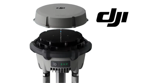
9. DJI recomienda RTK dongle para phone-added points
Cuando se añaden points mediante mobile phone, DJI recomienda un RTK dongle para mejorar accuracy.
10. Esta section no identifica un phone-RTK model específico
No convierta esa recommendation en una exact product claim si el accessory model no está documentado en la source.
11. Mark loading points
En Task Settings, seleccione los points que servirán como loading locations.
12. Mark unloading points
Haga lo mismo con unloading locations. Mantener la función de cada point explícita reduce confusión durante cargo operations.
13. Use Go para enviar el aircraft al destino
Un selected point puede abrirse con Go, haciendo que el aircraft vuele directamente hacia ese destination.
14. Direct flight does not remove pilot responsibility
Que el aircraft vaya automáticamente a un point no significa que pueda resolver por sí mismo todos los route hazards.

15. Critical limitation: no automatic obstacle bypass
DJI indica explícitamente que durante lift operations el aircraft cannot automatically bypass obstacles.
16. Plan around people, livestock and obstacles
Antes de guardar la route, inspeccione surroundings y evite locations donde people, livestock u obstacles puedan interferir.
17. Use an intermediate destination point to route around an obstacle
Si un obstacle está sobre la task route, DJI indica añadir un nearby destination point para que el aircraft pueda volar hacia ese point y rodear la hazard.
18. Do not expect the sensing system to solve a bad route
La limitation del manual es clara: el operator debe diseñar una path segura en vez de depender de automatic bypass.
19. Route planning should include vertical and horizontal context
Aunque esta section no publica clearance values para cada obstacle, el operator debe evaluar la geometry completa del route y evitar paths con people o obstacles.
20. Loading and unloading point placement
Seleccione áreas que permitan el cargo-grounding procedure y suficiente separation para que ground crew entre solo después de que el aircraft se haya alejado.
21. Plan with sling length in mind
El sling guide especifica 10–15 m. La exact cargo-handling geometry depende del sling length y surroundings, así que un task point no debería colocarse en una zona donde no exista espacio para ese sequence.
22. Team planning workflow
- enter Agras Lift;
- choose point-entry method;
- add loading locations;
- add unloading locations;
- invite collaborators if needed;
- verify phone-added point accuracy;
- review obstacles/people/livestock;
- add intermediate routing points where needed;
- save/confirm task settings;
- brief ground crew before operation.
23. Multi-user planning needs naming discipline
Cuando varias personas añaden points, use a simple convention para distinguir loading, unloading y route-intermediate points. El manual define funciones, pero una team naming practice mejora execution.
24. Verify every point before first use
Un point colocado por map, RC, aircraft o phone debe revisarse dentro del real environment antes de confiarle una suspended load.
25. Planning log recommended
- task name;
- aircraft ID;
- planning method per point;
- loading points;
- unloading points;
- intermediate obstacle-routing points;
- RTK used for phone points;
- crew participants;
- date/time;
- known hazards.
26. If phone point appears inaccurate
No continúe simplemente porque el point sincronizó. Reposicione o verify con un method más precise; DJI específicamente recomienda RTK dongle para improved accuracy.
27. If obstacle appears after planning
Update the route. No dependa de automatic bypass porque esta operation mode no lo ofrece.
28. If people enter the route
Pause/replan rather than treating the saved path as immutable.
29. Hardware context remains separate
Task planning controla flight path. Sling, hook, payload system, weight sensing y cargo attachment requieren sus propios inspections.
30. T100 and T70P hardware paths
Use the complete T100 Payload Lifting System Kit or T70P Lifting System appropriate to the aircraft.
31. Error común: confiar en automatic obstacle avoidance
La source dice que lift operations no bypass obstacles automáticamente.
32. Error común: phone point sin accuracy check
DJI recomienda RTK dongle para mejorar accuracy.
33. Error común: task point en zona sin espacio para crew separation
Planifique loading/unloading considerando el cargo-handling workflow completo.
34. Preguntas frecuentes
¿Cómo entro a Agras Lift?
Mode switch en Operation View → Agras Lift.
¿Cómo agrego points?
Crosshair, RC, Aircraft o phone vía SmartFarm.
¿Puedo marcar loading y unloading?
Sí, en Task Settings.
¿Phone points necesitan RTK?
DJI recomienda RTK dongle para mejorar accuracy.
¿El aircraft bypass obstacles automáticamente?
No durante lift operations.
Fuente y revisión
Fuente principal: DJI T70P / T100 Lift System User Manual v1.0 (2025.07), sección 3.1.