DJI D-RTK 3 AG Site Selection & Tripod Setup Guide
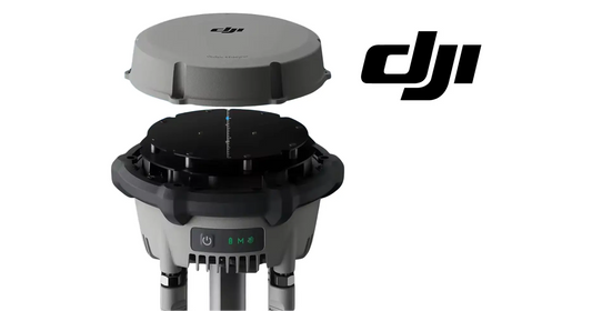
RTK performance begins with the physical site. DJI's D-RTK 3 AG setup section defines a clear-sky requirement, interference separation distances and a tripod workflow designed to keep the station level and fixed once positioned.
Quick Answer: Choose an open, unobstructed site. Keep obstructions out of the zone more than 15° above the antenna's horizontal plane, stay at least 200 m from high-power radio-emission sources and at least 50 m from high-voltage transmission lines, and avoid large bodies of water or other strong satellite-reflection sources. Use the Survey Pole and Tripod kit, keep the tripod stable and do not change the station's position or angle after leveling unless you are prepared to readjust it.

Protect the GNSS sky view
DJI says the setup environment requires a wide field of view. Trees, buildings or other obstructions should not occupy the zone more than 15° above the horizontal plane of the D-RTK 3 AG antennas, because those obstructions can absorb or block GNSS signals.
Reduce radio interference
Use the station in an open, radio-interference-free environment and avoid wireless devices operating in the same frequency bands. DJI specifies at least 200 m from high-power radio-emission sources such as television or microwave stations.
Keep away from high-voltage transmission lines
The source specifies at least 50 m from high-voltage transmission lines to reduce electromagnetic interference with GNSS signals.
Reduce multipath effects
Stay away from large bodies of water or objects that strongly interfere with satellite reception. These environments can contribute to multipath behavior and degrade positioning quality.
Mount the station on the Survey Pole and Tripod kit

DJI says to use the Survey Pole and Tripod kit, sold separately, and to make sure the tripod remains stable during use. The top of the D-RTK 3 AG should remain relatively level with the horizontal surface.
Do not move the station after leveling
Once the tripod is leveled, do not change the position or angle of the tripod or D-RTK 3 AG without readjusting the setup. The manual also notes that the survey-pole level bubble can shift after transportation and can be re-leveled using the bottom screw.
Weather and physical handling
The usage section tells operators to take water-resistant measures in rain or snow, use caution around lightning, avoid collision with the precision station, and be careful with the sharp ends of the survey pole and tripod. When elevating the setup, consider toppling and electrical hazards in the surrounding area.
The verified equipment path for the station itself is the DJI Agras T100 D-RTK 3 High-Precision GNSS Mobile Station. A separate active Survey Pole and Tripod product page was not verified in the current catalog, so this guide does not invent one.
Parts & Equipment Referenced in This Guide
Shop Related Collections
Related Tutorials
- D-RTK 3 Setup, Linking, PPP, Network RTK & Custom Coordinates
- How to Calibrate the DJI D-RTK 3
- First Charge & Activation
Source and revision note
Primary source: DJI D-RTK 3 AG User Manual v1.0 (2025.07), pp. 7-9.