DJI Agras T100 Tutorial: How To Map Fruit Trees (FAA Part 137 & FAA Part 107)
Share
🇺🇸 U.S.A. FIRST — DJI AGRAS T100 FRUIT TREE MAPPING & ORCHARD ROUTE PLANNING
This Ares Acres Operator Academy tutorial explains the complete workflow for mapping an orchard with a DJI Agras T100, reconstructing the orchard map, correcting AI tree identification, selecting Standard, Targeted, or Custom fruit-tree routes, reviewing the route in 2D and 3D, and preparing the aircraft for a subsequent orchard application. It also separates the mapping workflow from the U.S. operating authority that may apply to the aircraft and to any later spraying operation.
Ares Acres supports DJI Agras operators with aircraft, OEM parts, technical education, diagnostics, and field-operating resources. This tutorial is designed to turn the DJI training workflow into a practical field reference that an operator can use before, during, and after orchard mapping.
Quick links: Ares Acres Home · DJI Agriculture Tutorials · DJI Agras T100 Parts · DJI Agras OEM Parts · DJI Agriculture Accessories · Contact Ares Acres
Prefer to watch instead of read? The video above demonstrates the source workflow. The written guide below expands the procedure, adds planning logic, separates mapping from spraying, and flags settings that should be verified against your current T100 firmware, DJI Agras app version, aircraft authorization, pesticide label, and site conditions.
What You Will Learn
- How DJI Fruit Tree Mapping differs from an ordinary field boundary mission.
- How to prepare an orchard for a mapping flight before the aircraft leaves the ground.
- How to create the orchard boundary with the crosshair tool and understand the generated mapping route.
- Why the source training workflow uses an empty tank and a dedicated mapping flight.
- How mapping photos are used to reconstruct a working orchard map.
- How to review and manually correct AI tree identification.
- When to choose Standard, Targeted, or Custom fruit-tree route planning.
- How Fixed Spot, route spacing, height above crops, course angle, obstacle bypass, route smoothness, and waypoint editing affect orchard operations.
- How to review routes in both 2D and 3D before application.
- How route segmentation and spray/spread segment controls work in the source workflow.
- How to interpret the example application settings shown in the training video without treating them as universal spray recommendations.
- How FAA Part 107, Part 137, Part 91, and Section 44807 can intersect with agricultural UAS operations in the United States.
Quick Answer: What Is DJI Agras Fruit Tree Mapping?
Fruit Tree Mapping is a DJI Agras mapping workflow intended to create a detailed operational representation of an orchard. Instead of simply drawing a field polygon and immediately generating parallel spray lines, the aircraft first flies a mapping mission, captures imagery, and uses that imagery to reconstruct the orchard. The operator can then review AI-detected trees, correct mistakes, and create an orchard-specific route.
The workflow is best understood as five separate stages:
| Stage | What the operator does | Primary objective |
|---|---|---|
| 1. Reconnaissance | Inspect orchard terrain, obstacles, boundaries, takeoff area, lighting, wind, and access. | Decide whether the site can be mapped safely. |
| 2. Mapping plan | Create the orchard polygon, verify the generated mapping route, and set the course angle. | Cover the orchard with usable imagery. |
| 3. Mapping flight | Fly the automated mapping task while maintaining active supervision and VLOS. | Capture the image set needed for reconstruction. |
| 4. Reconstruction / AI correction | Review the reconstructed map and correct tree-identification errors. | Create an operationally useful orchard model. |
| 5. Orchard route planning | Choose Standard, Targeted, or Custom mode and review the final application route. | Create a route appropriate to tree distribution, terrain, obstacles, and treatment method. |
This distinction matters. A mapping mission is not the same thing as a spraying mission. The source video recommends an empty tank for the survey flight. That reduces unnecessary aircraft weight and avoids carrying application material when the objective is only imagery and reconstruction. The later orchard route can then be configured for spraying or another supported application after the operator has reviewed the reconstructed field.
Compatibility and Scope
This article follows the DJI T100 Fruit Tree Mapping workflow shown in the supplied DJI training video and cross-checks the overall mapping concept against DJI's T100 documentation. DJI's T100 user documentation identifies both Route Mapping and Fruit Tree Mapping as mapping options and describes mapping as the process of capturing images of farmland or orchards so the app can reconstruct a high-definition map for later planning.
Menus, icons, labels, obstacle logic, reconstruction behavior, route-generation rules, and available parameters can change with aircraft model, region, remote-controller firmware, DJI Agras app version, and aircraft firmware. If your screen differs from this tutorial, use the current interface and the current DJI manual for your exact aircraft rather than forcing the sequence shown here.
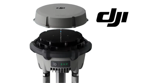
Useful T100 resources from Ares Acres include the DJI Agras T100 aircraft, the DJI Agras T100 full set, the DJI Agras T100 D-RTK 3 High-Precision GNSS Mobile Station, and the complete T100 OEM parts collection.
FAA Part 107 vs Part 137: Why the Title Includes Both
For U.S. operators, the regulatory framework depends on what the aircraft is doing, the aircraft's takeoff weight, and the authorization under which the mission is conducted. The mapping workflow itself does not magically convert an operation into a Part 107 or Part 137 mission.
| Framework | General relevance | Important limitation |
|---|---|---|
| FAA Part 107 | General U.S. small-UAS framework for qualifying civil operations. | Part 107 applies to small UAS under 55 lb at takeoff. A heavier agricultural aircraft does not become Part 107-compliant merely because its spray tank is empty. |
| FAA Part 137 | Agricultural aircraft operations involving dispensing certain substances for agricultural purposes. | A mapping-only flight with no dispensing is conceptually different from the later application flight. Spraying/dispensing can trigger Part 137 requirements and an Agricultural Aircraft Operator Certificate. |
| Part 91 + exemptions | Can be relevant to civil agricultural UAS at or above 55 lb. | Authorization is operation-specific; do not assume a Part 107 Remote Pilot Certificate alone authorizes a heavy-UAS mission. |
| Section 44807 | A statutory exemption pathway for certain civil unmanned-aircraft operations outside ordinary Part 107 limits, including heavier aircraft. | The operator must comply with the terms and conditions of the actual exemption/authorization. |
The FAA's current agricultural UAS guidance explains that agricultural UAS below 55 lb, including the dispensed substance, may operate under Part 107 with required exemptions, while agricultural UAS at or above 55 lb are generally operated under Part 91 and Part 137 with applicable exemptions. The FAA also explains that Part 137 agricultural operations require an Agricultural Aircraft Operator Certificate. See the FAA's Dispensing Chemicals and Agricultural UAS, Part 107 overview, and Section 44807 pages.
Practical consequence: determine the legal authority for the mapping flight and the later spray flight separately. An empty tank changes aircraft weight, but it does not automatically place a large aircraft under Part 107. Actual takeoff weight and the operator's applicable approvals control. State pesticide-applicator rules, pesticide labels, local requirements, airspace authorization, and the terms of any exemption or certificate can add additional obligations.
Why Orchard Mapping Requires More Planning Than Drawing a Field
An orchard is a three-dimensional operating environment. The aircraft is not simply crossing an open field; it may be flying near tree canopies, windbreaks, irrigation infrastructure, utility lines, poles, buildings, trellises, slopes, ravines, roads, workers, vehicles, and terrain that changes significantly within a short horizontal distance.
Fruit-tree mapping adds another dependency: the quality of the later route depends on the quality of the map. If the original mapping flight misses part of the orchard, produces poor imagery, or reconstructs incorrectly, the operator can end up making route-planning decisions from a flawed model. That is why the source video places so much emphasis on checking the orchard before mapping and then checking the reconstruction after mapping.
Three layers of safety should agree
- Physical orchard reality: the actual trees, terrain, obstacles, boundary, access lanes, and neighboring property.
- Mapped digital reality: the satellite background, polygon, captured imagery, reconstructed map, and AI tree objects.
- Final flight plan: the generated route, waypoint heights, transitions, obstacle behavior, connection route, and RTH route.
If any of those layers disagree, stop and resolve the mismatch before application. A route that looks clean on a 2D map can still be unsafe in 3D. A perfect AI reconstruction can still omit a newly installed wire. A clear daytime mapping flight does not guarantee the spray route remains safe after equipment, vehicles, people, or weather conditions change.
Step 1 — Perform a Full Orchard Reconnaissance
The source video recommends conducting fruit-tree mapping on a sunny day and checking the orchard terrain thoroughly before beginning. The practical objective is not simply “sun.” It is to obtain adequate, consistent visibility and imagery while avoiding weather that degrades flight safety or reconstruction quality.
Walk or otherwise inspect the site before takeoff
Confirm the location and height of:
- Utility and communications lines, especially thin wires that can be difficult to perceive visually or detect reliably.
- Poles, towers, antennas, irrigation risers, pivot equipment, pumps, sheds, barns, wind machines, and orchard machinery.
- Windbreaks, tall isolated trees, dead branches, and trees extending beyond the apparent orchard edge.
- Trellises, bird netting, support cables, fencing, gates, and temporary structures.
- Roads, public access points, neighboring homes, livestock areas, workers, and vehicle routes.
- Terrain breaks, drainage channels, embankments, ditches, terraces, and steep elevation changes.
The source training video describes checking for obstacles in the volume roughly 30 m above the task area because the mapping workflow shown there includes a vertical climb of approximately 30 m before the aircraft proceeds to the start of the mapping route. Treat that as source-video workflow information, not a universal clearance rule. The actual required obstacle-free volume depends on your current route, transition path, mapping altitude, aircraft behavior, RTH configuration, terrain, and local environment.
Step 2 — Choose the Takeoff and Landing Area
The source video recommends planning the takeoff and landing points inside the mapping area. The underlying objective is to keep the launch location operationally connected to the field and to simplify transitions between the home point, mapping route, and landing area.
A good launch point should provide:
- A stable, reasonably level surface with enough room for the aircraft and ground crew.
- Clear vertical and lateral space for takeoff, climb, descent, and landing.
- Strong controller-to-aircraft communication and suitable positioning reception.
- Unobstructed observation of the aircraft for the intended VLOS operation.
- Separation from workers, vehicles, animals, chemical-mixing activity, and unnecessary spectators.
- A safe home-point location for the mission's RTH logic.
Do not choose a launch point solely because it sits inside the polygon. A point inside the orchard but directly beneath power lines, beside a tall windbreak, or in a deep terrain depression can be a poor home point. Evaluate the entire transition and RTH environment.
Step 3 — Map With an Empty Tank When the Mission Is Only Mapping
The source DJI workflow instructs the operator to empty the tank before the mapping flight. That is a sensible separation of tasks: the mapping aircraft is gathering imagery, not applying material. Removing unnecessary liquid reduces aircraft weight and can improve available flight endurance for the survey mission.
This also creates cleaner operating discipline. Chemical loading, application-rate decisions, droplet selection, and treatment authorization belong to the later application phase. The mapping phase should focus on imagery, obstacle awareness, route coverage, and reconstruction.
Before powering the system, make sure the tank is actually in the condition required for the intended mapping flight, the aircraft is mechanically serviceable, batteries are appropriate for the mission, and the aircraft's current configuration matches the manufacturer's requirements. If you need T100 components or support, see DJI Agras T100 OEM Parts or contact Ares Acres.
Step 4 — Power On the Remote Controller and Aircraft
Follow the normal DJI power-on sequence for your current T100 configuration. Allow the controller, aircraft, positioning system, and DJI Agras app to initialize completely before building or launching the mapping mission.
Before proceeding, review aircraft warnings instead of dismissing them. Verify:
- Aircraft battery state and health.
- Remote-controller battery state.
- Positioning status and Home Point status.
- Compass, IMU, radar/LiDAR/vision or other sensing warnings shown by the current system.
- Link quality.
- Firmware/app compatibility warnings.
- Airspace or operational prompts that require action.
A mapping route should not be used as a workaround for an unresolved aircraft warning. The map can be perfect and the aircraft can still be unfit to fly.
Step 5 — Enter Fruit Tree Mapping Mode
In the source workflow:
- Open the operation view in the DJI Agras app.
- Select the Operation Mode Switch.
- Choose Fruit Tree Mapping.
- Select Add.
- Choose the Crosshair option under Add Point.
DJI's T100 documentation also identifies Fruit Tree Mapping as one of the available mapping workflows. If the menu wording or location has changed in your software version, use the current DJI T100 manual and the current app interface rather than assuming the older menu position remains exact.
Official DJI references: DJI T100 Tutorials and DJI T100 Downloads.
Step 6 — Draw the Orchard Boundary With the Crosshair
Use the satellite map to locate the orchard. Drag the crosshair to a turning point on the orchard boundary and select Add. Continue around the orchard in sequence until the polygon represents the intended mapping area.
Boundary-planning rules that improve the result
- Use genuine physical corners and meaningful changes in boundary direction rather than adding excessive points.
- Do not cut inward across tree rows simply because the satellite image is unclear.
- Do not assume an old satellite image shows current obstacles or current orchard expansion.
- Check whether the polygon includes the tree canopy rather than only trunks or row centers where that distinction affects coverage.
- Account for irregular edge rows and isolated trees that belong to the treatment area.
- Keep neighboring property, roads, structures, and sensitive areas in mind when the generated route extends beyond the polygon.
As points are added, the right-side information window in the source workflow displays the mapping area, estimated photo count, and estimated flight time. Use those estimates as planning aids. They are not guarantees of exact flight time because actual endurance can vary with battery condition, temperature, wind, aircraft state, altitude, and route execution.
Step 7 — Understand the Generated Mapping Route
The source DJI training workflow states that the mapping route extends approximately 5 m beyond the orchard boundary to help ensure complete coverage and that the route automatically aligns with the orchard's longest side to improve mapping efficiency. The operator can use the yellow course-angle control to alter the direction when site conditions make another orientation preferable.
Why the 5 m extension matters operationally
That extra coverage can improve edge reconstruction, but it also means the aircraft may fly outside the polygon you drew. Therefore, inspect what exists outside every orchard edge. A road, power line, neighboring crop, structure, people, or property boundary can be relevant even if it lies beyond the polygon.
Why course angle matters
Aligning with a long orchard dimension can reduce turns and improve mapping efficiency, but efficiency is not the only objective. A different course angle may be preferable if it creates safer transitions, better obstacle separation, more manageable wind exposure, or more reliable VLOS. Use the yellow course-angle control as a planning tool, not merely a way to make the route look geometrically neat.
After confirming the area and route are appropriate, select Save to store the mapping task.
Step 8 — Final Mapping Preflight Before Start
Before starting the saved task, conduct a deliberate go/no-go check. At minimum, confirm:
| Item | Question |
|---|---|
| Weather | Are wind, visibility, precipitation, temperature, and lighting suitable for this aircraft, this imagery task, and this site? |
| Orchard | Has the physical site been inspected for wires, poles, trees, trellises, terrain, people, vehicles, and temporary hazards? |
| Mapping polygon | Does the digital boundary match the orchard that should actually be mapped? |
| Route extension | Is the generated route safe even where it extends beyond the drawn orchard boundary? |
| Transition path | Is the climb and route from Home Point to the first mapping leg clear? |
| Aircraft | Are there any unresolved warnings, damage, loose parts, abnormal motors, sensor problems, or battery concerns? |
| Tank | Is unnecessary liquid removed for the mapping-only flight? |
| Positioning | Are Home Point and the required positioning signals established and stable? |
| VLOS | Can the remote pilot / visual observer structure maintain the required visual awareness for the mission? |
| RTH | Has the RTH route and altitude been considered against actual obstacles? |
Step 9 — Start the Fruit Tree Mapping Task
Select the saved mapping task and choose Start. The source workflow then presents the task-start control on the remote controller. Complete the required confirmation/slider action only after verifying the aircraft status and route.
The source video states that the aircraft rises vertically approximately 30 m from the takeoff point and then travels toward the start point of the mapping route. Because this transition can occur before the aircraft begins the repetitive imaging legs, the vertical volume above the Home Point and the connection route to the mapping area must be treated as part of the mission—not as empty space between “real” route segments.
During the flight, mapping photos are transmitted to the controller and used to generate a preview. Continue supervising the aircraft itself. A controller preview is useful information but does not replace maintaining the awareness required to detect unexpected aircraft behavior, people, vehicles, birds, changing weather, or obstacles.
Step 10 — Know How to Pause the Mission
The source tutorial explains that the control sticks can be used to pause the mapping task in an emergency. The exact response to a stick input can depend on aircraft mode and software behavior, so operators should know the current aircraft's pause/cancel logic before launching.
Examples of conditions that should trigger an immediate reassessment include:
- An obstacle that was not identified during reconnaissance.
- Unexpected people or vehicles entering the operating area.
- Rapid wind change, precipitation, visibility deterioration, or other adverse weather.
- Positioning degradation, link warnings, sensor warnings, or navigation anomalies.
- Unexpected route geometry or an aircraft transition inconsistent with the reviewed plan.
- Bird activity or another aircraft entering the area.
- Battery behavior inconsistent with the remaining mapping distance.
The safest response is not always “resume.” Pause, determine what changed, and only continue if the mission remains safe and authorized.
Step 11 — Complete Mapping and Return the Aircraft
After the mapping mission is complete, the source video recommends the one-button RTH function: press and hold the RTH control for approximately two seconds to command the aircraft to return to the Home Point, and use the flight-mode control to cancel RTH if necessary.
Treat RTH as an automated flight phase that still requires supervision. Before using it, confirm that the Home Point is valid, the positioning system is functioning normally, the selected RTH logic and altitude are suitable, and the return path is clear of obstacles.
If the aircraft needs manual intervention near the landing area, act according to the current DJI flight-mode behavior and your operating authorization. The goal is a controlled landing, not rigid adherence to automatic return when conditions have changed.
Step 12 — Allow the Map to Reconstruct
After landing, the image set is used to reconstruct the orchard map. The purpose of reconstruction is to convert individual mapping photos into a coherent operational surface that the app can use for later orchard planning.
Do not rush directly from “reconstruction complete” to application. First inspect the product. Look for:
- Missing areas or blank patches.
- Distorted orchard edges.
- Rows that appear shifted or duplicated.
- Tree canopies merged into one object.
- Individual trees omitted from AI recognition.
- Non-tree objects incorrectly identified as trees.
- Structures, roads, shadows, or vegetation that confuse the reconstruction.
- Elevation or terrain representation that does not make sense compared with the physical site.
If the map itself is materially incomplete, correction of individual AI tree points may not be enough. Consider whether a new mapping mission is the proper solution rather than trying to “repair” a poor base map through waypoint editing.
Step 13 — Review and Correct the AI Map
In the source workflow, select the reconstructed field and choose Modify AI Map. Turn on the AI display and inspect whether the identified orchard elements match reality.
If identification is inaccurate, the video instructs the operator to turn off the AI switch, select the AI element type Tree, move around the map, and use Add to rectify the task area. Once the AI elements have been corrected across the area, confirm the settings and save.
What “AI correction” really means
The AI result should be treated as a draft interpretation of the orchard, not an unquestionable survey. The operator is responsible for checking whether the digital tree centers and orchard geometry are operationally useful.
Common orchard-recognition errors
| AI/map issue | Possible cause | Operator response |
|---|---|---|
| Missing tree | Weak imagery, small canopy, shadow, overlap, or reconstruction artifact. | Compare against actual orchard and add/correct the tree element if supported and appropriate. |
| Two trees merged | Overlapping canopies or image resolution. | Inspect the actual row and correct the AI interpretation before using a tree-centered route. |
| False tree | Shrub, shadow, equipment, isolated vegetation, or map artifact. | Remove/correct the erroneous element so Targeted mode does not route through the wrong object. |
| Tree center shifted | Reconstruction alignment or canopy geometry. | Correct the location where the route depends on the center point. |
| Edge rows incomplete | Insufficient mapping coverage near boundary. | Determine whether manual correction is sufficient or remapping is safer. |
Step 14 — Enter Orchard Route Planning
Once the field and AI map are acceptable, select the field and enter Route Planning. The source workflow provides three orchard modes: Standard, Targeted, and Custom.
| Mode | How route is created | Best fit described in source video | Main operator concern |
|---|---|---|---|
| Standard | System generates equidistant, continuous routes through the task area. | Large orchards with relatively uniform planting. | Verify row/route alignment, spacing, terrain, and obstacle clearance. |
| Targeted | System creates routes that pass through detected tree centers. | Orchards with regularly distributed trees. | AI tree-center accuracy becomes critical. |
| Custom | Operator manually creates waypoints that are connected in sequence. | Irregular orchards requiring manual route design. | Greater planning flexibility also creates greater responsibility for waypoint order, transitions, altitude, and application segments. |
Standard Mode: When Uniform Geometry Helps
Standard mode is the closest of the three orchard modes to a conventional coverage pattern. The system creates continuous, evenly arranged routes across the task area. It can be efficient when tree rows and canopy distribution are sufficiently uniform that a consistent route structure makes agronomic and flight-safety sense.
Before accepting Standard mode, verify that:
- The route direction makes sense relative to tree rows and terrain.
- The planned route spacing supports the intended coverage without creating unnecessary overlap or gaps.
- The route does not force repeated close passes to obstacles along one orchard edge.
- The terrain-following behavior is appropriate for the slope and canopy variability.
- Connection routes and turns remain inside a safe operating volume.
Standard mode can reduce planning effort, but uniform geometry does not make a non-uniform orchard uniform. If the orchard contains large gaps, irregular blocks, varied canopy height, or complex obstacles, another planning method may provide more control.
Targeted Mode: Tree-Center Routing
Targeted mode uses the orchard reconstruction and identified trees to create routes through tree centers. This is why the AI-review stage should not be treated as optional housekeeping. If the tree centers are wrong, the logic that depends on them can also be wrong.
Targeted mode can be useful when trees are regularly distributed and the operational objective benefits from tree-centered treatment. Review the entire route rather than spot-checking a few trees near the launch point.
Use Fixed Spot deliberately
The source workflow says that Fixed Spot can be enabled in Targeted and Custom modes so the aircraft applies material only above the tree center. That can fundamentally change the treatment pattern. Confirm that fixed-spot application is appropriate for the crop, material, label, canopy, equipment configuration, and agronomic objective before enabling it.
Do not infer that “tree center” automatically equals “correct treatment point.” Canopy size, tree architecture, target pest/disease, nozzle setup, wind, material, and label directions may require a different application strategy.
Custom Mode: Maximum Flexibility, Maximum Planning Responsibility
Custom mode allows the operator to add waypoints manually according to the actual tree distribution. The waypoints are connected sequentially into the route. This can be valuable in orchards with irregular spacing, missing trees, isolated blocks, obstacles, or nonstandard geometry.
Custom mode also removes some of the protection that comes from a predictable auto-generated pattern. Every manually placed waypoint affects the next transition. Therefore, inspect not only the waypoint itself but also the line segment connecting it to the previous and next waypoint.
Questions to ask for every custom waypoint
- Is the horizontal position correct relative to the actual tree/canopy?
- Is the altitude safe relative to the ground, treetop, and nearby objects?
- Does the incoming segment pass safely around obstacles?
- Does the outgoing segment remain inside the intended operating area?
- Should application be on or off on this segment?
- Does the aircraft need an abrupt heading or altitude change that should be smoothed?
- Will the route remain safe if positioning accuracy is less than perfect?
Route Spacing and Height Above Crops
In Standard and Targeted modes, the source workflow allows route-spacing adjustment. Route spacing is the distance between adjacent flight routes. This is an operational parameter, not a cosmetic one: it influences coverage, overlap, route count, mission time, and how the application interacts with canopy width.
Height Above Crops refers to the vertical distance between the aircraft and the treetops in the source workflow. That differs from a fixed altitude above the takeoff point. In sloped orchards or orchards with changing canopy height, the two concepts can diverge substantially.
Do not copy route spacing or height from another orchard simply because the crop name is the same. Consider canopy architecture, tree spacing, row spacing, slope, obstacle environment, aircraft application system, desired coverage, material, label, and the current DJI guidance.
Course Angle
Course angle controls the directional orientation of orchard flight routes. The “best” direction balances several competing objectives:
- Row alignment and application consistency.
- Number and geometry of turns.
- Wind direction and crosswind exposure.
- Terrain gradient.
- Obstacle separation.
- VLOS and operator observation.
- Connection-route simplicity.
- Boundary and neighboring-property constraints.
A route aligned with the longest side may minimize turns, but a slightly less efficient route can be operationally superior if it keeps the aircraft farther from a utility line or creates safer turns.
Obstacle Bypass: Do Not Generalize a Toggle Without Checking Your Current System
The supplied training transcript states that, in the demonstrated fruit-tree planning interface, disabling a particular Bypass Obstacles option causes the aircraft to bypass obstacles from above, while enabling it causes the aircraft to bypass obstacles from the sides.
Because obstacle-avoidance behavior can be highly dependent on aircraft firmware, app version, route type, sensing configuration, obstacle geometry, and other settings, treat this as behavior shown in the source training workflow, not a universal rule for every T100 or every firmware version.
Before relying on obstacle bypass:
- Read the current DJI T100 operating documentation.
- Confirm what the exact toggle means in the current app.
- Identify obstacles manually during reconnaissance.
- Build the route with deliberate clearance rather than intentionally sending the aircraft toward a known hazard to “test” avoidance.
- Keep thin wires, netting, branches, cables, and other difficult-to-detect hazards out of the route volume.
Obstacle sensing should be treated as an additional protective layer, not the primary method of route design.
Route Smoothness and Terrain Following
The source video describes Route Smoothness as a tradeoff: a value closer to 1 creates smoother terrain-following flight, while a value closer to 0 follows terrain more precisely but can create less-smooth aircraft motion.
This setting should be considered in the context of orchard terrain and canopy. Very aggressive vertical tracking may be undesirable if small height variations cause constant aircraft movement, while excessive smoothing may be undesirable if it allows the aircraft's actual height above canopy to diverge too far from the intended value over rapidly changing terrain.
Review the resulting 3D route rather than deciding from the numeric setting alone.
Modify AI Map From Advanced Settings
The source workflow also makes AI-map correction available from advanced planning settings. This is useful because errors often become obvious only after a route has been generated. For example, a Targeted route may reveal that one tree center was misplaced or that an entire edge row was omitted.
If you discover an AI-map error during route review, fix the underlying map rather than trying to compensate with a chain of awkward waypoints when the software provides a proper correction workflow. A cleaner base map usually produces a cleaner and more maintainable route.
Waypoint Editing — Understand the Altitude Reset Warning
The source tutorial includes an important sequencing warning: if you edit waypoint altitude and then later edit the overall flight route, the waypoint altitude adjustment may be reset. The demonstrated interface warns the operator in a pop-up before continuing.
This means route planning should proceed from coarse to fine:
- Finalize field geometry.
- Finalize route mode and overall route structure.
- Finalize major route parameters.
- Then make fine waypoint-position and altitude adjustments.
- After any later structural change, re-check every customized waypoint.
Do not assume a previously reviewed altitude remains saved after changing the route. Re-open the 3D view and verify.
Use 3D View as a Safety Review, Not Just a Visualization
The source workflow instructs the operator to select 3D to inspect the route height relative to the ground and surrounding objects. Use this view to answer three separate questions:
- Coverage: Does the route actually cover the intended orchard?
- Obstacle clearance: Does the planned trajectory stay well clear of mapped and physically known hazards?
- Boundary clearance: Does the route remain appropriately separated from the operating boundary, sensitive areas, and neighboring property?
Then inspect individual waypoints. The training workflow allows the operator to select a waypoint and adjust altitude with plus/minus controls or enter a desired offset within a displayed range of approximately -30 m to +30 m.
That software adjustment range is not a declaration that every value in the range is safe or legal. A technically accepted input can still produce an unsafe trajectory. Use the smallest change that produces the required safe and agronomically appropriate route, then re-check adjacent segments.
2D Waypoint Editing
In 2D view, select a waypoint and use the side-menu controls shown in the training workflow to move it forward, backward, left, or right. You can also add a new waypoint by moving the map and selecting Add.
Whenever a waypoint moves, inspect the new connecting segments. Moving a point away from one obstacle can accidentally pull the incoming line across another obstacle. The route must be reviewed as a continuous path.
Reset and Delete
Reset cancels previous waypoint operations in the source workflow, while Delete removes the selected waypoint. Use these functions to keep the route clean rather than accumulating unnecessary corrective points.
Spray/Spread Segment Control
The source workflow includes a Spray/Spread switch for route segments. When enabled, the aircraft performs the configured application on that segment. When disabled, the route segment turns white in the demonstrated interface and the aircraft does not apply material on that segment.
This is particularly important around:
- Non-crop gaps between orchard blocks.
- Road crossings.
- Headlands or access lanes that should not receive treatment.
- Transitions between isolated trees.
- Sensitive areas where the label or site plan prohibits application.
Do not rely only on route-segment color when reviewing a mission. Verify the application state intentionally, especially after copying, segmenting, or editing a route.
Route Segmentation
The source video shows a route-segmentation workflow using Settings, selecting a task area, confirming the selection, saving, and then choosing Use. Segmentation can be valuable when one reconstructed orchard needs to be divided into manageable operating blocks.
Reasons to segment an orchard can include battery logistics, refill logistics, different application rates, terrain, obstacles, crop variety, treatment zones, wind exposure, or the need to keep the active aircraft closer to the crew.
After segmentation, inspect each segment independently. Confirm that the start/end transitions, application on/off states, connection routes, and RTH behavior still make sense for the selected block.
Source-Video Application Settings: Examples, Not Universal Recommendations
The training transcript includes specific numeric values for orchard application. These should be treated as demonstration settings from the source workflow, not as universal agronomic prescriptions.
| Mode | Source-video example | How to use this information safely |
|---|---|---|
| Standard / Targeted | Amount-based setting; transcript renders application rate as “225 L/CAR”; droplet size 100 μm; flight speed 1.5 m/s; height above crops appears to be 4 m. | Verify the unit shown in your current DJI interface and original video. Do not copy the rate unless it matches the product label, crop, target, equipment configuration, and agronomic plan. |
| Custom | Flow-based setting; 15 L/min; droplet size 100 μm; flight speed 1.5 m/s; height above crops appears to be 4 m. | Treat as a demonstration of which parameters can be configured, not a blanket recommendation for every orchard. |
The transcript's “225 L/CAR” wording appears to be a transcription or unit-rendering issue. Do not publish or operate from an uncertain unit. Confirm the exact value and unit shown in the current controller/app and follow the pesticide label and applicable law.
Why copying settings is risky
Orchard application is affected by canopy density, row spacing, tree height, target pest or disease, material, label requirements, nozzle/disc configuration, droplet spectrum, flow capability, wind, temperature, humidity, terrain, desired deposition, and legal restrictions. The correct combination for one crop and label may be inappropriate for another.
For T100 spray-system service items, see the T100 OEM centrifugal spray nozzle set and T100 OEM water tank inlet filters. Verify exact compatibility before ordering or installing any component.
Task Area Calculation
The source video notes that the method used to calculate the task area should be selected according to the actual situation. This matters in orchards because “acreage inside a polygon,” “tree-treated area,” and “actual application path” can represent different quantities.
For recordkeeping and application planning, know what the controller's selected area calculation actually represents. If your pesticide label, state reporting requirement, customer invoice, grant record, or agronomic prescription depends on treated acreage, do not assume every displayed area value is interchangeable.
Connection Route, RTH Speed, and RTH Altitude
At the final start screen, the source workflow instructs the operator to review aircraft status and task settings and to set connection-route and RTH speed/altitude values appropriately before sliding to start the application task.
These settings deserve the same attention as the orchard route itself because accidents can occur before the aircraft reaches the first tree or after it leaves the last one.
Connection route
The connection route links the aircraft's current/home area to the planned task. Verify that it does not cut across trees, poles, utility lines, buildings, people, neighboring property, or terrain that was not represented correctly in the digital map.
RTH altitude
Choose an RTH strategy consistent with the actual obstacle environment and the current DJI manual. Too low can create collision risk; simply setting an arbitrarily high value is not automatically better because airspace, battery reserve, wind, aircraft behavior, and operational limits also matter.
RTH speed
Use a value that fits the aircraft, mission, obstacle environment, authorization, and available battery reserve. The operator remains responsible for supervising the return.
Final Start Sequence for the Orchard Application
After route planning is complete:
- Select Start.
- Review aircraft status and task settings.
- Confirm the intended route segment and field.
- Verify application parameters against the label and mission plan.
- Verify connection route.
- Verify RTH behavior, altitude, and speed.
- Confirm Home Point and positioning status.
- Confirm the operating area is clear.
- Complete the start slider/confirmation.
- Supervise the automatic takeoff and route execution continuously.
Automation reduces repetitive stick input. It does not transfer command responsibility to the software.
Recommended Orchard Workflow: From Survey to Application
| Phase | Go condition | No-go / correction condition |
|---|---|---|
| Site reconnaissance | Obstacles, boundaries, terrain, launch area, and people/vehicle access are understood. | Unknown wires, uncertain boundary, inaccessible terrain, uncontrolled public access, or unverified obstacle volume. |
| Mapping plan | Polygon and generated route match the intended orchard; route extension is safe. | Route crosses an obstacle/sensitive area or digital map does not match physical orchard. |
| Mapping flight | Aircraft stable, imagery progressing, link/positioning normal, VLOS maintained. | Unexpected obstacle, weather change, warning, link/positioning degradation, or route anomaly. |
| Reconstruction | Map is complete and coherent. | Missing/warped areas or poor reconstruction that would undermine route planning. |
| AI correction | Tree centers and orchard elements match physical reality sufficiently for the selected mode. | Missing/false/misplaced trees that would distort a Targeted or Fixed Spot route. |
| Route planning | Standard/Targeted/Custom mode fits orchard geometry and treatment objective. | Mode forces unsafe or agronomically unsuitable path. |
| 3D/2D review | Route covers intended area and maintains deliberate obstacle/boundary clearance. | Altitude reset, abrupt transitions, unsafe segments, or unverified custom waypoint. |
| Application setup | Rate/flow, droplet, speed, height, and segment states match approved plan and label. | Copied demo values, uncertain units, or parameters not reconciled to label/site. |
| Launch | Aircraft, crew, connection route, RTH, Home Point, weather, and area all remain acceptable. | Any material change from conditions used to approve the plan. |
Troubleshooting Fruit Tree Mapping
| Problem | Likely category | What to check |
|---|---|---|
| Fruit Tree Mapping option is missing | Software / compatibility | Aircraft model, region, app version, firmware, controller login/status, and current DJI manual. |
| Satellite map does not match orchard | Background imagery | Use physical reconnaissance and mapping imagery; do not force boundary points to outdated satellite features. |
| Estimated mapping time looks too long | Polygon / course angle / area | Check accidental extra boundary point, overly large polygon, route orientation, and task area. |
| Generated route extends into unsafe area | Boundary margin | Remember source workflow can extend outside orchard polygon; change plan/course/area as needed. |
| Aircraft climbs toward obstacle after takeoff | Transition path | Stop/pause according to current aircraft procedure; mapping climb and connection route must be pre-cleared. |
| Preview photos appear incomplete | Mapping execution | Review route progress, camera/image status, link, aircraft warnings, and whether the task was interrupted. |
| Reconstruction has blank sections | Image coverage / reconstruction | Determine whether enough source imagery exists; remap if the base model is not reliable. |
| AI misses trees | Recognition | Use Modify AI Map and compare against physical orchard; add/correct tree elements as supported. |
| AI marks shrubs/equipment as trees | Recognition | Correct false positives before Targeted/Fixed Spot planning. |
| Targeted route misses actual tree centers | AI-map accuracy | Correct the underlying tree elements, then regenerate/review the route. |
| Custom route jumps across orchard | Waypoint sequence | Inspect waypoint order and connecting segments; delete/re-add misplaced points. |
| Waypoint altitude adjustment disappears | Route edit reset | Source workflow warns that later route edits can reset customized waypoint altitude; recheck after structural changes. |
| Route looks safe in 2D but not 3D | Terrain / altitude | Use 3D review, verify ground/canopy relationship, and compare against physical terrain. |
| Aircraft would spray across a road/gap | Segment application state | Use Spray/Spread segment controls only after verifying the intended no-application segment and label/legal requirements. |
| Route is too close to wires | Planning failure | Redesign route. Do not rely on obstacle sensing to detect thin wires. |
| RTH path conflicts with orchard obstacle | Return planning | Correct RTH/route plan before launch; Home Point and RTH settings must account for real obstacles. |
| Mapping completed but application should not proceed | Changed conditions | Reassess weather, crew, bystanders, crop condition, chemical plan, authorization, and aircraft state. A successful map does not compel a spray launch. |
Operator Best Practices That Improve Mapping Quality
1. Map before the orchard becomes operationally chaotic
Conduct the survey when vehicles, harvest crews, pruning crews, sprayers, ladders, bins, and temporary equipment are controlled. Temporary objects may interfere with the operation even if they are not permanent orchard features.
2. Keep the mapping mission simple
An empty-tank mapping flight separates imagery acquisition from chemical application. That reduces the number of simultaneous decisions the crew must manage.
3. Save a clean version before aggressive editing
When possible in the current workflow, preserve a known-good reconstruction or route state before major custom modifications so mistakes can be identified and corrected systematically.
4. Recheck after firmware or app changes
Do not assume a saved mental model of the UI remains valid after updates. Menu location, route logic, obstacle options, and parameter names can change.
5. Treat wires as manually planned hazards
Thin wires, cables, netting, and branches are exactly the kind of objects that should be avoided through route design rather than left to sensing.
6. Review the transition routes
Operators naturally focus on the beautiful repeating pattern over the orchard. Many mission problems can occur on takeoff, climb, connection to the first route, RTH, or final descent. Review those paths explicitly.
7. Reconcile the AI map with ground truth
Targeted mode and Fixed Spot depend heavily on where the system thinks the trees are. Physically verify questionable areas.
8. Keep application settings separate from mapping success
A good map does not validate a chemical rate. Application settings still require their own agronomic and legal verification.
Fruit Tree Mapping Preflight Checklist
- Confirm the exact aircraft model, firmware, controller firmware, and DJI Agras app version.
- Confirm the mission's FAA/airspace operating authority and any exemption/COA conditions that apply.
- For later dispensing, confirm Part 137/AAOC and applicable state pesticide requirements.
- Inspect orchard boundaries physically.
- Identify all wires, poles, structures, trellises, netting, tall trees, windbreaks, and terrain hazards.
- Choose a safe takeoff and landing area.
- Confirm Home Point logic and positioning status.
- Remove unnecessary liquid/material for a mapping-only flight.
- Confirm battery condition and expected mapping endurance.
- Confirm weather and lighting suitable for safe mapping and usable imagery.
- Open Fruit Tree Mapping.
- Create the orchard polygon with deliberate boundary points.
- Review estimated area, photo count, and flight time.
- Inspect the generated route beyond every orchard edge.
- Adjust course angle if safety or route efficiency requires it.
- Review the climb and connection route from takeoff to mapping start.
- Confirm VLOS and crew positions.
- Confirm no people/vehicles have entered the operating area.
- Review aircraft warnings.
- Start only when the physical orchard, digital route, and aircraft status agree.
Post-Mapping Checklist Before You Build the Spray Route
- Confirm the mapping task completed rather than merely ending early.
- Land and secure the aircraft.
- Allow reconstruction to complete.
- Inspect the entire reconstructed orchard, not only the center.
- Check edge rows, isolated trees, and irregular blocks.
- Turn on AI identification and inspect the result.
- Correct missing, false, or misplaced tree elements where the workflow supports it.
- Choose Standard, Targeted, or Custom mode based on orchard geometry and treatment objective.
- Decide whether Fixed Spot is appropriate.
- Set route spacing/height/course angle according to the real mission—not a copied template.
- Verify the current meaning of obstacle bypass settings.
- Review route smoothness against terrain and canopy.
- Make structural route changes before fine altitude edits.
- Review in 3D.
- Review in 2D.
- Confirm application on/off state for every special segment.
- Segment the task if operationally useful.
- Verify rate/flow/droplet/speed/height against label and agronomic plan.
- Verify connection route and RTH.
- Perform a new go/no-go check immediately before the application launch.
DJI Agras T100 Fruit Tree Mapping FAQ
1. Can the DJI Agras T100 map fruit trees?
Yes. DJI's T100 tutorial and user documentation include a Fruit Tree Mapping workflow that captures orchard imagery for reconstruction and later orchard route planning.
2. Is Fruit Tree Mapping the same as a spray mission?
No. Mapping captures imagery and reconstructs the orchard. The later application route is a separate phase. The source video recommends conducting the mapping flight with the tank emptied.
3. Why should the tank be empty during mapping?
The source workflow uses an empty tank to reduce unnecessary weight and extend useful mapping endurance. It also keeps the survey phase separate from chemical application.
4. Does an empty tank automatically make a T100 operation Part 107?
No. Part 107 applies to qualifying small UAS under 55 lb at takeoff. Actual takeoff weight and the operating authority control; removing liquid does not automatically place a heavy aircraft under Part 107.
5. Does Part 137 apply to mapping?
Part 137 concerns agricultural aircraft operations involving dispensing qualifying substances. A mapping-only flight with no dispensing is different from the subsequent spray operation, although the aircraft may still require other FAA authority based on weight and mission.
6. What is Section 44807?
Section 44807 is an FAA exemption pathway used for certain civil unmanned-aircraft operations that fall outside ordinary Part 107 limits, including operations with aircraft at or above 55 lb. Operators must comply with the actual exemption terms.
7. Should fruit-tree mapping be done on a sunny day?
The source DJI video recommends sunny conditions. In practice, the operator needs weather and lighting that support safe flight and usable imagery. Avoid treating “sunny” as a legal requirement or as permission to fly in excessive wind or heat.
8. What is the approximately 30 m climb described in the video?
The source training workflow describes the aircraft rising roughly 30 m from the takeoff point before traveling to the mapping-route start. Verify current T100 behavior and clear the real climb/transition volume before flight.
9. Does the orchard need to be free of obstacles 30 m above it?
The video uses an approximately 30 m obstacle-planning concept around its mapping workflow, but a single number is not a universal safety rule. Inspect the actual climb, mapping route, connection route, RTH path, terrain, and surrounding obstacles.
10. Why does the mapping route extend beyond the orchard boundary?
The source workflow says the generated route can extend about 5 m beyond the orchard polygon to support complete mapping coverage. That makes inspection of neighboring space especially important.
11. Is the 5 m extension a geofence?
No. It is route-generation behavior described in the training workflow, not a protective boundary. The operator must ensure the actual route remains safe and authorized.
12. What does the yellow icon do during mapping planning?
In the source workflow, the yellow route-direction control lets the operator adjust course angle rather than accepting the automatically aligned mapping direction.
13. What information does the mapping screen estimate?
The training video shows estimated mapping area, photo count, and flight time. Treat these as planning estimates rather than guarantees.
14. What happens to mapping photos during flight?
The source workflow transmits mapping photos to the remote controller so a preview can be generated while the mission is progressing.
15. Can I pause a mapping mission?
The source video indicates that control-stick input can pause the task in an emergency. Learn the exact pause/cancel behavior of your current firmware and aircraft before launch.
16. Should I use RTH after mapping?
The source video recommends one-button RTH after the mapping task. RTH still requires a valid Home Point, functioning positioning, a safe return route, appropriate settings, and active supervision.
17. What is Modify AI Map?
It is the workflow used to inspect and correct the orchard's AI-recognized elements after reconstruction. If a tree is missed or identified incorrectly, the operator can correct the map using the supported editing tools.
18. Should I trust every tree detected by AI?
No. Treat AI identification as a planning aid. Compare it against the real orchard before generating a route that depends on tree centers.
19. What is Standard fruit-tree mode?
Standard mode generates continuous, equidistant routes through the task area and is described in the source video as suitable for relatively large, uniformly planted orchards.
20. What is Targeted mode?
Targeted mode generates routes through the centers of identified trees. It is described as useful when trees are regularly distributed, and it depends strongly on accurate AI tree positions.
21. What is Custom mode?
Custom mode lets the operator manually add waypoints that are connected in sequence. It is intended for irregular orchards or cases requiring manual route design.
22. What is Fixed Spot?
In Targeted and Custom modes, the source workflow allows Fixed Spot so application occurs only above tree centers. Whether that is agronomically appropriate depends on crop, canopy, material, label, and treatment objective.
23. What is route spacing?
Route spacing is the distance between adjacent flight routes in Standard and Targeted modes. It affects overlap, coverage, route count, and mission time.
24. What does Height Above Crops mean?
It refers to the distance between the aircraft and the treetops, not simply altitude above the takeoff point.
25. What does Bypass Obstacles do?
The supplied training workflow describes a toggle that changes whether bypass occurs over or around obstacles. Because this behavior can be version- and configuration-specific, verify the current T100 manual and app rather than generalizing the transcript.
26. What does Route Smoothness do?
The source video describes values nearer 1 as smoother terrain-following and values nearer 0 as more precise but less smooth terrain following. Review the resulting route in 3D.
27. Why did my waypoint altitude reset?
The source workflow warns that editing the route after making waypoint-altitude changes can reset those altitude changes. Recheck all custom waypoint heights after structural route edits.
28. Why should I use 3D view?
3D view helps evaluate route height relative to terrain and surrounding objects, field coverage, obstacle separation, and boundary clearance.
29. Can I move individual waypoints in 2D?
Yes, the source workflow provides controls to move a selected waypoint and also supports adding or deleting waypoints.
30. Can I stop spraying on one route segment?
The source video shows a Spray/Spread segment toggle. When off, the demonstrated route segment turns white and application is disabled on that segment. Verify the current app state before launch.
31. What is route segmentation?
Route segmentation divides a larger task into selected operating areas or route sections. It can help with refill, battery, treatment-zone, terrain, or operational logistics.
32. Should I use 225 L/ha, 100 μm, 1.5 m/s, and 4 m for my orchard?
Do not copy those values as universal recommendations. The transcript contains a possibly mistranscribed rate unit and presents the values as a training example. Use the pesticide label, crop prescription, current DJI limits, nozzle/application configuration, and applicable law.
33. Can I use 15 L/min in Custom mode?
The source video gives 15 L/min as a demonstration value for its Custom-mode example. It is not a blanket flow recommendation.
34. Does a successful mapping flight mean the orchard is ready to spray?
No. You still need a valid reconstruction, corrected AI map, safe route, verified application parameters, current weather, legal authorization, aircraft readiness, and a new go/no-go check.
35. Can obstacle sensing replace orchard reconnaissance?
No. Wires, cables, netting, branches, and other hazards can be difficult to detect. Plan deliberate clearance instead of routing toward known hazards.
36. Where can I learn more about DJI Agras T100 operations?
Use DJI's current T100 manuals/tutorials and the Ares Acres DJI Agriculture Tutorials library. Ares Acres also maintains model-specific OEM parts and operator resources.
Continue Learning: DJI Agras T100 Operator Academy
Fruit Tree Mapping fits into a broader T100 operating system. Continue with these Ares Acres resources:
- DJI Agras T100 Safety Tutorial
- DJI T100 Flight Tutorial: Plot Multiple Fields and Program Autonomous Flights
- DJI T100 Customizable Flight Tutorial
- DJI Agras T100 A-B Operation Mode Tutorial
- DJI T100 D-RTK 3 Tutorial
- DJI T100 Power Supply, Battery & Generator Tutorial
- DJI Agras Night Flight Safety Tutorial
- DJI T100 Spreading System Tutorial
- DJI T100 Lift System & Transportation Tutorial
- DJI T100 Auger Size Guide
Relevant T100 Equipment and OEM Parts
- DJI Agras T100
- DJI Agras T100 Full Set
- DJI Agras T100 D-RTK 3 High-Precision GNSS Mobile Station
- DJI Agras T100 OEM Centrifugal Spray Nozzle Set with Solenoid Valve
- DJI Agras T100 OEM Water Tank Inlet Filter (10 Pcs)
- DJI Agras T100 Parts
- DJI Agras OEM Parts
- Ares Acres Product Catalog
What Is Ares Acres?
Ares Acres is a U.S.-based agricultural robotics company focused on DJI Agras aircraft, OEM replacement parts, technical support, diagnostics, and practical operator education. Our goal is to help agricultural drone operators move beyond simply owning an aircraft and toward building reliable, serviceable, repeatable operating systems.
That is why the Ares Acres Operator Academy does not stop at a short video transcript. We turn each workflow into a technical field reference: what the feature does, how the steps connect, where operators commonly make mistakes, which settings are mission-specific, how to troubleshoot the workflow, and how the procedure interacts with real aircraft service and regulatory requirements.
Need T100 parts or technical support?
Browse the DJI Agras T100 OEM Parts Collection, explore the full DJI Agras Parts Catalog, or contact Ares Acres with the aircraft model, exact warning/error, operating context, and the part or system you are diagnosing.
Final Operational Takeaway
Fruit Tree Mapping is most valuable when it is treated as a disciplined data-to-route workflow rather than as a button that automatically solves orchard flight planning. Start with physical reconnaissance. Build a mapping polygon that reflects the real orchard. Review the generated route—including the space outside the polygon. Fly the mapping mission with active supervision. Inspect the reconstruction. Correct AI tree identification. Choose the route mode that matches the orchard. Review every critical transition in 2D and 3D. Then verify application settings, connection route, RTH, aircraft readiness, and legal authorization before launching the actual treatment mission.
For U.S. operators, remember that mapping and dispensing are distinct operational questions. Part 107 applies only within its small-UAS scope, while larger agricultural aircraft and agricultural dispensing can involve Part 91, Part 137, Section 44807 exemptions, an Agricultural Aircraft Operator Certificate, airspace requirements, and state pesticide rules. Follow your actual authorizations and the current FAA/DJI documentation.
Technical and regulatory review note: This article was prepared for the Ares Acres DJI Agriculture Tutorials library using the supplied DJI Fruit Tree Mapping training workflow and current public DJI/FAA references available in August 2026. Software behavior and regulations can change. This is educational material, not legal advice, pesticide-label guidance, or a substitute for the current DJI manual, FAA authorization, exemption terms, AAOC requirements, state law, pesticide label, or qualified on-site operational judgment.