DJI D-RTK 3 AG User Manual: Setup, Activation, Indicators, Positioning & Maintenance
This D-RTK 3 AG manual hub reorganizes DJI User Manual v1.0 (2025.07) into focused visual tutorials. The source is only 15 pages, so the build stays topic-driven: first use, physical field setup, status interpretation, positioning, firmware/logs, storage and the one explicit part-replacement procedure.
Quick Answer: Charge and activate the station before first use, choose an open interference-controlled site, mount and level it on the Survey Pole and Tripod kit, then choose the appropriate positioning mode. Use the indicator guide for battery/GNSS status, DJI Assistant 2 for firmware and log export, and the storage guide for long-term battery care.

D-RTK 3 AG visual manual index
- Setup: Components, First Charge & Activation
- Site Selection & Tripod Setup
- Indicator Troubleshooting: Power, GNSS, Firmware, Linking & Reset
- Existing Positioning Tutorial: Setup, Linking, PPP, Network RTK & Custom Coordinates
- Firmware Update & Log Export with DJI Assistant 2
- Storage & Battery Care
- Antenna Replacement: 13 mm Tool & 15 kgf·cm Torque


Positioning modes

The manual says PPP is suitable where Network RTK is unavailable, Network RTK or Custom Network RTK is suitable where network service exists, and Custom Coordinates is used at a location with saved or known coordinates. If the station is restarted or moved during ionospheric activity, the manual instructs operators to return it to the same location and use the saved coordinates in Custom Coordinates mode.
Indicators and maintenance


Exact product and collection paths
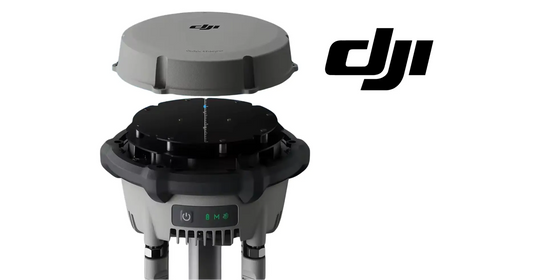
The direct hardware path is the DJI Agras T100 D-RTK 3 High-Precision GNSS Mobile Station. For T100 deployments, activation and configuration use the DJI Agras T100 OEM Remote Controller. Broader navigation hardware is organized under the DJI Agras T100 Radar, RTK & Sensor Parts collection.
The manual's Appendix does not publish numerical specifications; it directs users to DJI's current specifications page. For that reason, this manual cluster intentionally does not invent a standalone specifications article from unsupported numbers.
Parts & Equipment Referenced in This Guide
Shop Related Collections
Related Existing Tutorials
- DJI Agras T100 D-RTK 3 Tutorial
- How to Calibrate the DJI D-RTK 3
- T100 Remote Controller & DJI Agras App Guide
Source and revision note
Primary source: DJI D-RTK 3 AG User Manual v1.0 (2025.07), pp. 3-14.